“The joy of living is his who has the heart to demand it.” – Theodore Roosevelt.
National parks are dangerous, they are remote, rugged and have an abundance of wildlife (a.k.a. bears). In the days leading up to our trip to Lassen (pronounced [lass-uhn]) National Park I did a lot of reading about places to go and winter activities in the park. Everything I read made Lassen seem more and more dangerous. In addition to the normal ruggedness, wildlife and remote location this park also has frequent avalanches and rock falls, a likelihood for high wind and white out conditions, puddles of boiling acidic mud scattered alongside the trails and is centered around an active volcano; while an eruption is highly unlikely it is called active for a reason. Thankfully, this was a spur of the moment trip so there wasn’t much time to get anxious about the looming hazards; we packed our bags, didn’t tell our Moms what we were doing and set out for a weekend of snowshoeing.
On Friday at 9 AM we drove through the unmanned ranger station at the north entrance of the park, as we pulled into visitor center parking lot, we excitedly noticed there was not another car in sight! We were officially the only people there! As we unloaded our gear from the car we realized we had only brought one half empty nalgene for the entire day, uh oh. So add lack of water and no other humans for miles onto the growing list of risk factors. Luckily, the restroom facilities were open so we topped off our one and only bottle and figured we could refill it with snow if we got really desperate.
After signing into the log book outside the visitor center we wandered into the snow to strap on our snowshoes. Being our first time it took us (me) a little while to get the shoes strapped on. After finally getting situated it immediately dawned on us how difficult navigation is when the trails are buried under three feet of snow! The only information we had on the trail/route we were taking from Manzanita Lake to Chaos Crags was this tiny paragraph and drawing from the park newsletter. 
We read the newsletter a few times and then set off, blindly following the tracks from previous snowshoers. After walking for a quarter of a mile, we had a spirited discussion about whether or not we were on the trail. “Are we still on the trail?” and “I don’t know..” were by far the most common phrases from the entire weekend. I decided we should go back to the start and more deliberately follow the newsletter instructions instead of the existing tracks. So back to the bridge we went to course correct. It turned out we were in fact not on the trail and quickly determined where we needed to go. That however, did not last long. We were supposed to be looking for yellow tree markers, which were extremely infrequent and hard to spot. They seemed to appear every quarter of a mile and there were trees everywhere, which tree were we supposed to look at? There were also ski and snowshoe tracks going in every direction all over the place! For all of the threats of avalanches and acidic mud pots lurking around every corner it seemed that everyone was perfectly comfortable to blaze their own trail.

Hidden tree marker.
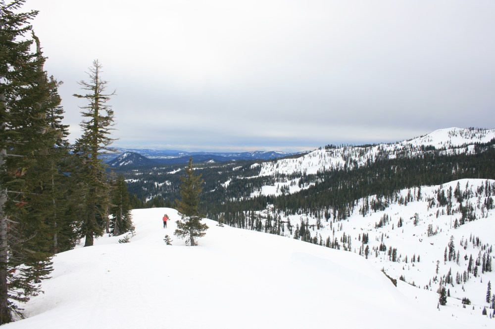
We continued in what we assumed was close enough to the right direction with nothing but the sound of our swishing rain pants and the snow crunching beneath us to break the silence. Every so often we would lose the previous tracks we were following and allowed instinct to guide us. Eventually we came to a clearing in the trees and saw Chaos Crags looming above us. Chaos Crags are lava domes that were formed by a volcanic eruption 1,100 years ago. Steep snow covered slopes littered with huge chunks of gray rock, otherwise known as the jumbles, which we affectionately called crumbles, separated us from the tall jagged peaks ahead. The jumbles were left from a rock avalanche 300 years ago that flattened parts of the forest and created Manzanita Lake (by damming the creek) where our trek had started. With the trees no longer obstructing our view, I began deliberately marching up the mountainside. After a while we determined we were definitely off the trail and decided to take a lunch break on a pile of jumbles. We took some pictures, enjoyed the views and planned our route for the rest of the afternoon.

The view of Chaos Crags from the park road.

Just another tree down on the “trail”.

Spending some more time looking at the map.

Lunch break!

Jumbles along the slopes.

Fresh tracks.
On the way back down the mountain we decided to follow ski tracks straight down to the road so we could create a loop with another trail in this section of the park. Our description for this trail was equally lacking in details, but this time we would be looking for orange trail markers. After snowshoeing down the road for about 1.5 miles we started to spot some orange ribbons tied around the trees. We studied the curves and bends in the road as compared to the map and found where it appeared that the trail crossed the road and headed into the woods. We followed the orange ribbons weaving through the trees and were happy to see a ribbon every couple hundred of feet or so. The conditions however were not pleasant, we were constantly ducking under branches and stepping over fallen logs. How could this be a National Park trail? We continued spotting ribbons and weaving through the woods like two kids following a treasure map. Suddenly, the ribbons stopped appearing. Not this again! After a few desperate circles in every direction we gave up and headed back in the towards the road. Just as we were about to make it to the road Ryan spotted an orange tree marker (not ribbon!), we were never even on the trail to begin with! We continued to follow the orange tree markers only significantly loosing track of the trail once more on our hike back towards the car. After 10 miles and 1,400 feet of climbing our feet were soaked and our legs were tired.

Part of our GPX file from day 1; we were kind of on the trail! Red line = us. Yellow line = trail.

Ready for our second day of snowshoeing!
For our second day of snowshoeing we drove from our cabin down to the Southwest entrance to the park. During the summer the park road is open between the two entrances, but in the winter the road is closed, so we had to drive 90 minutes back through small towns to get to the entrance. The drive traveled scenic winding roads through farms and and sprawling green pastures. Cows lazily grazed in the pastures which were blanketed in volcanic rock. As we continued driving Lassen peak grew smaller and smaller in the distance, but this seemed to have no bearing on the density of rocks spread across the fields. While this part of trip wasn’t even inside the national park boundaries, it gave me a real appreciation for the gravity and magnitude of volcanic eruptions.
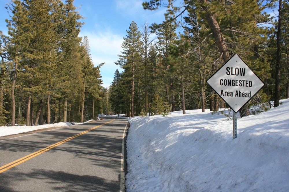
As we approached the park the road quickly gained elevation. Upon entering the park the snow was piled so high on either side of the road that it felt like we were driving through a canyon. Even the visitor center was buried! We parked our car and started strapping on our gear. There was certainly a lot more activity on this side of the park, but calling the park crowded would be a stretch. Despite the ski and snowshoe celebration event and families sledding near the entrance we still found ourselves on the trail with no one in sight several times. Our first destination on day two’s hike was Sulphur Works. This is one of the areas in the park where visitors can experience lot of volcanic activity firsthand. We got to stand right next to a boiling mud pot and observe steam rising out of rocks and hillsides. The steam and boiling mud are a result of snow melt and rain seeping into the hydrothermal system beneath the park. Here the water is heated by molten rock and the boiling water and steam rise back to the earth’s surface through cracks in the rocks. As we marveled at the interesting features Ryan mentioned that it smelled like fireworks, I on the other hand said the smell reminded me of downtown Cleveland. Ahh, fresh air with a strong sulfuric odor!

A boiling mud pot!

Being careful not to get too close!
We had planned to hike to Ridge Lake from Sulphur Works, but by this point we had already passed the trailhead parking lot. Like everything else it was hard to spot in all of the snow. The restroom rooftop just barley peeking out from the snow was the only indication that we had passed the parking lot. Instead of back tracking we decided to follow an older couple that seemed to be experienced telemark skiers onto what we thought was the ranger cut off. The couple was attempting to ski to Bumpass Hell, an area of the park with the most volcanic activity. Getting there requires taking a cut off trail up and over a mountain in order to avoid the avalanche prone area accessed by the road. We followed them off the road and quickly passed them as it was much easier for us to climb the steep slopes in snowshoes. As we continued on the hill got very steep and it felt like we were scaling a wall. We decided to head back down and continue exploring along the road. There was a bend up ahead with some expansive views so we agreed to go that far.

Blazing our own trail, again!

Standing on top of the trailhead.

Waiting for Ryan at the top.
As soon as we crested the corner of the road we saw a sign for the ranger cut off trail! Oy vey! Once again following others had lead us astray! We decided to check out this trail and started climbing. As you can imagine, since the cut off takes you up and over a mountain instead of around it, it was steep. Ryan was struggling the higher we climbed so we decided to take a break in a cluster of trees for lunch. There was no where to sit so we just sat down in the snow. We started getting wet and cold and the longer I sat there the more I thought my fear of heights might cause me some anxiety on the descent. We headed downward and to my surprise my fears stayed at bay. Snowshoes (and snow) are awesome!
After that we headed up to Ridge Lake. Luckily, there were tons of tracks headed up this trail so we were confident we could find our way there. Though previous experience should have taught us not to rely on old tracks. The Ridge Lake trail rises 991 feet in 1 mile to a small alpine lake. Everything we had conquered on day two was steep, but this was the steepest yet. In some places the slopes we were walking up were 30-45% grade! It was insane. About two thirds of the way up it started snowing! At first we were both excited and tried (for the most part unsuccesfully) to catch the snow flurries in our pictures. After living in the desert for 8 years a few flurries are rather exciting. As we continued on and looked behind us the skies were gray and visibility was deteriorating. Ryan wondered if we should turn back in case the conditions got worse, I on the other hand found this as motivation to hike faster. We only had a third of a mile to go. Finally we made it to the lake, which didn’t look like much of a lake at all, just another expanse blanketed in snow. Add another hazard to the list – wandering out onto thin ice!

Ryan at Ridge Lake.

Snowflakes!

The creek that followed alongside Ridge Lake trail.
On the way down there were a few tricky sections where we had to be careful due to the extreme slopes. Luckily the snowshoes make it so much easier to handle steep terrain. It was really tempting to sled down the hill on our butts, but we were too concerned about our snowshoes getting caught on something, resulting in a twisted ankle. So down, down, down the mountain we hiked. Once we reached the bottom it was one a short mile back to the visitor center – another epic day of snowshoeing in the books! On the way back to our cabin we stopped at a local vineyard, Indian Peak Vineyards in Manton, for a little relaxation. We enjoyed a free wine tasting with generous pours and a delicious taco bar, which even had vegetarian options! The winery was in a barn and the owners hospitality and company of the other guests was great. And we finally learned that it’s pronounced Lass-uh-n not Law-sen!