Bikepacking
Bikepacking the Craters and Cinder Cones Loop
Saturday May 5 6 AM, Williams Arizona
We circled the block on Historic Route 66 trying to find a restaurant that was open. It was just after dawn so we got to experience the quaint, quiet charm of Route 66 without the normal hustle and bustle from cross country tourists. We parked our bikes outside of the Grand Canyon Coffee & Cafe walked inside eager to warm up. Looking forward to the cool temperatures of the high country we both failed to remember how cold the early mornings are in late spring. As a result we had a cold night at Dogtown Lake and I was currently pedaling in my long underwear – along with every other piece of clothing I had packed.
When we walked into the restaurant, peeling off our layers of clothing, we were greeted by a welcoming smile from our waitress. She was a young Hispanic woman and the only other person working the front was her mom, who was busy enjoying breakfast with her mija (granddaughter). There was only one other customer inside, he was just finishing his breakfast and gave the granddaughter a pat on the head when he left – clearly a regular. We wrapped our hands tightly around our coffee mugs while waiting for our huge omelettes. In addition to hastily packing my clothing for the trip, I also decided to try a new dehydrated dinner on Friday night and failed to realize the meal had only two hundred calories – not even close to enough after six hours of bikepacking. I was starving!
We took our time enjoying our breakfast, waiting for the temperatures to warm up a bit before heading back out. While we were eating some more regulars walked in. Our waitress and her mom were happy to see the two older gentlemen dressed in cowboy hats and starched jeans, they all exchanged pleasantries like old friends. During the course of their conversation I learned that our waitress also worked at the Western wear store in town. They started discussing different brands of jeans the store carried and how most of them are made in China these days. This seemed to bother the men who began talking about how everything should be made in a America, and furthermore “we should put up a wall around all four sides to keep all the bad people out.” Our waitress politely smiled throughout the entire conversation, while the men cackled. From there the conversation got even weirder as one of the men, who was probably pushing 70 bragged about his recent trip to Vegas and how he’s always talking to ten different girlfriends at a time. America.
Saturday May 5 10 AM, Coconino National Forest
As usual, it didn’t take long to warm up and by now we were back to our shorts and t-shirts making our way back towards Flagstaff. Friday we had covered 58 miles on smooth fast forest roads. The only thing difficult about the riding was getting acclimated to the elevation. The first climb to Lowell Observatory and Observatory Mesa got my lungs working, but after that it was flat and fast miles. However, 27 miles into day two we were now tackling a much different type of terrain. I guess the route name (Craters and Cinder Cones) and the fact that we were riding through volcanic fields should have made it obvious that there would be rocky segments. We picked our way through boulder strewn two track as we steadily climbed back towards Kendrick Mountain. I found this part of the route to be extremely engaging, and it was a nice confidence boost for me to see that all of my work on technical bike handling skills was paying off. There were several small sections that required short bursts or attention to line choice and I was happy to see that I was able to ride everything without getting off to hike. Always my worst critic, it’s rare that I’m able to reflect in the moment and appreciate how far I’ve come. And to give credit to where credit is due, this is in large part due to Ryan’s and my coach Dave’s patience, encouragement and willingness to deal with me as they continually help me push past my comfort zone. Disclaimer: there was one very short section that I had to walk where the grade got very steep and I made a poor line choice – luckily it was only a few steps to push up the hill and jump back on my bike.
By now we were approaching one of the longest climbs in the route. I hadn’t spent much time looking at the route before we left, but knowing enough about the general area and seeing the elevation profile I had a feeling we were going to be climbing a long hill steep hill that would put us onto the Barn Burner course (except going in reverse). I had some experience with this particular hill because when I was training for Barn Burner in 2016 I blew past the sharp left turn to the rocky downhill in one of my training rides, I was having too much fun flying down a steep hill and then painfully realized I passed my turn and had to climb back up. Sure enough, this was the hill in the Craters and Cinder Cones Loop. It’s not a particularly fun climb and took a lot of me on this occasion. Luckily the top of the hill marked was less than ten miles from our resupply water tank where we agreed to take a short break to eat and refill our water.
Saturday May 5 4 PM, Spring Fed Stock Tank
Our weekend trip on the Craters and Cinder Cones Loop was serving as a dress rehearsal for our upcoming trip to Mongolia. One last trip to test out all our gear and assess any last lessons learned (such as bring warmer clothes and make sure dinner is calorie dense). We were also testing out our new water filtration kit. The Craters and Cinder Cones Loop has a long stretch without reliable water. There are several stock tanks along the way, but they are often dry and stagnant. This was supposedly the most reliable water source on this section of the route, and luckily had plenty of relatively clean water. Our mini sawyer filtration pouches were a pain to fill up because the water wasn’t flowing and the water level wasn’t very high so it was difficult to submerge the pouches deep enough so they would fill up quickly. When we arrived the tank, Ryan immediately got to filtering while I started eating. This was becoming a trend, on Friday night while he was setting up the tent I prioritized eating candy and sending my Mom selfies to let her know we were doing OK.
After getting some food down I asked Ryan how I could help, my first job was to use the steripen to sterilize the water Ryan had already filtered. I accidentally dropped the entire device into the bottle and a bunch splashed out. Luckily there was no damage the steripen. I kept sterilizing the water, but eventually outpaced Ryan because the water pouch took so long to fill up. So I started to help filter the water while Ryan kept collecting it. After roughly thirty minutes, we filtered two and half liters of water. It was then that Ryan realized I didn’t close his bladder securely and over half of the water had spilled on the ground! Without skipping a beat, Ryan resumed collecting more water and I stumbled around aimlessly asking him what I should do to help, to which he replied “I hear you’re good at using the Steripen!” In dramatic fashion I responded by asking Ryan why he even brings me on these trips since I can’t help him with anything, “What am I good for companionship?” I asked and without hesitation Ryan gave a resounding “No!” A reference to my introverted and independent nature. A few days after we got back Ryan posted a seeming sentimental Instagram post in which he bragged that I’m the best adventure companion a guy could ask for. Wink wink.
After we’d successfully collected five liters of clean water we started riding away from the Kendrick area towards SP Crater to the East. We were headed downhill now, but the terrain was not getting any easier. We rode through rocky sections and small rock gardens as we descended from Kendrick. This was the only portion of the ride where I was longing for my hardtail mountain bike instead of the rigid drop bar bike I was riding. Luckily it only lasted for about ten miles and I was practically overjoyed when we got to a graded dirt road (FR 417) near the AZT. My body was getting beat up after thirty slow and chunky miles, making mindless pedaling on a smooth dirt road a welcome relieve. Unfortunately, it didn’t last very long because as soon as we made it to Cedar Ranch the road became extremely washboarded and we were riding into a fierce headwind. This type of riding is not very physically demanding, but I find it hard to stay mentally engaged. I found myself battling my inner voice because it kept telling me to stop, which always results in slower and slower pedaling if I’m not focused and intentional. Luckily I remembered some of the tricks I learned at Dirty Kanza and thought about Rebecca Rusch’s advice when she said, you can either run over hot coals or walk over hot coals, but you still have to go over hot coals. In this case the hot coals were annoying washboards.
Fortunately, we kept getting different views of Mt. Humphrey in the distance, which was still snow covered and beautiful. We were still riding through a ranching area and rode past a few pairs of mares and tiny foals. The young horses were all legs and so cute. There were also cows everywhere, and they were quite skittish. These cows weren’t very smart, because they kept running in the direction we were going, which was frightening because inevitably they’d always choose to cross the road in front of us without any warning. There were several calves too, which were cute and there was always one straggler that wasn’t paying attention when the rest of his group ran off. I tried to stop and get a picture of one tiny guy running right across the road in front of Ryan and when I lingered because I couldn’t get my phone back in its case this seemed to upset all of the cows. We were surrounded by easily a hundred cows in all directions and now all the ones in close proximity were mooing at us, “let’s keep moving, they aren’t happy!” Ryan shouted to me. A few miles later we were through the cow fields unscathed.
One of the best parts of the Craters and Cinder Cones loop is how much the landscape varies in the short 185 mile route. Up to this point we had ridden through typical alpine forests you expect in the high country, expansive meadows and rocky mountainous terrain. Now we were entering lava fields and a crater strewn landscape. It’s hard to describe the scene, but it was other worldly. As we got closer to SP crater it felt more and more remote. We hadn’t seen anyone in hours. Eventually we were tired of cycling and ready to eat dinner so we decided to stop. We’d ridden close to 90 miles for the day, our longest fully loaded distance to date. We set up camp on the side of the road, just a few paces in, tucked between some bushes and trees so that if anyone (or thing) did travel by we wouldn’t be bothered. We quickly set up camp and ate dinner in the remaining hour of daylight. It was silent. When the sun went down we got inside the tent ready to get some sleep as we still had a significant amount of climbing ahead of us to finish the route. As soon as our heads hit our inflatable pillows we both heard footsteps. We looked at each other and Ryan asked “What was that?!” At that point I realized I left my knife on my bike and was feeling quite vulnerable, even though I’m not too confident that I can better protect myself with said knife in hand. I made Ryan poke his head out both sides of the tent. He shimmed his head out the small doors, still laying inside his sleeping bag – if there was anything out there, neither one of us were in the attack position. Ryan didn’t see anything. We laid back down and started looking at a few pictures on the camera only to hear the footsteps again. Now we were getting freaked out, but again could not figure out where the noise was coming from. Was it our imagination or the sound of our own breathing?
Sunday May 6 7 AM, Sunset Crater National Monument
Sunday morning we cleaned up camp and pressed on toward Sunset Crater National Monument. We had a big climb ahead of us, and in the route description this was one of the areas that riders are warned about potential hike a bike, as the route goes uphill through soft, deep cinders. This turned out to be fairly similar to riding through sand. While the climbing was not swift we never had a to hike and slowly made our way up to the visitors center. The ground was so soft that it was super quiet riding and we both were in awe of our surroundings. Most inspiring was the fact that trees were growing and thriving on a cinder covered landscape. For some sick reason I get a significant amount of pleasure from grinding up a steep (non-technical) incline, I think it’s because this is where my strength in endurance and pacing really shines. I was pedaling along thinking about the fact that the ground was so soft that it was almost like we were riding on a carpet, a magic carpet…I broke out into song doing my best rendition of Jasmine and Aladdin. When we got to the Sunset Crater visitor center we refilled our water, which luckily did not need to be filtered and I enjoyed the Baby Ruth bar I’d been carrying around since we left a gas station in Williams.
The Craters and Cinder Cones loop ends with a real crescendo, with a seven mile climb gaining two thousand feet. As we climbed upwards we both commented on how the first segment of the route was by no means an indication of the difficulty of the rest of the route. However, the mix in scenery and variable difficulty make the route really enjoyable, because eventually, it always changes. When we got to Lockett Meadow we had a choice to take a rocky side road or the Inner Basin trail up to Waterline Road. We decided to take the single track, which was an amazing trail that wove through a dense Aspen grove. We were both too tired and mentally fried to ride up Inner Basin, but a one-and-a-half mile hike was actually a welcome relief after so much riding the past few days. Surprisingly we were pushing our bikes faster than some people were hiking despite our heavy load and clipless carbon soled mountain biking shoes. The Aspen were so dense that at times when I looked up too quickly I became dizzy and it felt like I was in some kind of psychedelic Alice and Wonderland scene. After the Inner Basin trail we rode down Waterline and back to our car which was parked at the Schultz Trailhead area. Waterline was littered with downed trees and we had to stop and get off our bikes multiple times to lift them up and around the debris. It was slow going, but when we finally got to Schultz we could let it rip and quickly got back to our car in time to enjoy a pint at Mother Road before driving back down to the valley. All in all it was a great weekend, with my favorite adventure companion.
To learn more about this route check out bikepacking roots, huge thanks to Kurt Refsnider for creating and sharing this epic route!
Bikepacking the San Rafael Valley
“Are we going to die?” I asked for the second time since Ryan had shared the route with me. We were driving down to Patagonia, Arizona on a Friday evening for a short weekend of bikepacking. Patagonia is a small town in Southern Arizona, roughly 20 miles north of Nogales. For some reason I was still convinced that the border was dangerous and kept pestering Ryan about our well being. The last time we were in Southern Arizona for an Arizona Endurance Series event at Kentucky Camp we saw several border patrol agents. As we continued driving I was adamant that the border was still hazardous with ranchers getting shot by the drug cartel and illegal immigrants. After a quick google search I realized the story I was remembering about an Arizona rancher getting shot and killed on his ranch was from 2010. A realization that revealed the lasting impact negative news coverage creates. Feeling ignorant, I decided to stop asking Ryan about the route and trust his judgement.
We arrived at the Harshaw road trailhead for the Arizona Trail after dark and started to set up camp. The parking lot was pretty dumpy, with trash strewn about. Ryan started to pitch our tent and after I reluctantly put my headlamp on and got out of the car to help him I noticed he was setting up the tent right on top of a huge ant hill. We moved a few hundred yards away and settled in for the night.
After an uneventful night and morning we packed up our bikes and set out towards the Mexico border. Previously, when I questioned Ryan about route safety he explained that we would be riding past people’s homes so there was nothing to worry about. Unconvinced I told him I was going to keep track of how many houses we saw to prove a point, sadly, I lost count during the first couple of hours. We rode past several ranches over our two day ride. While the landscapes were vast and we didn’t see many people it never quite felt remote. Our first pit stop was the old ghost town of Harshaw. On our way there we passed a handful of pickup trucks that apparently worked for a security company. One truck stopped us to notify us that we were approaching some heavy equipment on the road up ahead. We never saw the heavy equipment, but we passed several warning signs that read “No Recording. No Videos. No Photographs.” Perplexed and preoccupied dreaming up a wild conspiracy theory we pedaled onward. Shortly after our encounter with the security company, we arrived in the old town center of Harshaw. The town was completely abandoned and there were only remnants of a few buildings remained. It was hard to fathom that we were standing in a place that was a boom town in the late 1800s, before the mines dried up and a fire destroyed the area.
After leaving Harshaw, Ryan decided that we should take a detour to an old mine. The detour added a mile or two to the route, but also required us to climb an extremely steep hill. It had been a while since we had been bikepacking so I wasn’t used to hauling the weight up hill. We got to the site of the mine shaft and took a few minutes to take it all in. It reminded me of the Netflix mini series, Godless. A western that is set in an old mining town in Colorado. Naturally, I started quoting the movie in my best western drawl. I love Westerns so this put me in a good mood while I caught my breath before we descended back down the hill to get back on our route.
The landscape began to open up as we continued through the San Rafael Valley. The pristine dirt roads formed a wide smooth path between endless fields of rolling grasslands. The views stretched on forever. Southern Arizona gravel makes for easy pedaling, the only challenge is that there is always wind. Our final pit stop before the border was a memorial monument for Fray Marcos de Niza, the first European west of the Rocky Mountains. The memorial was in the middle of nowhere and I wonder how many people have ever seen it, it prompted a discussion about being the first ever to accomplish something and left me pondering questions with no answer such as legacy and the temporal nature of our lives.
As we neared the Arizona-Mexico border we passed a few working ranches and an old Spanish style church. The landscape was beautiful, valleys and hills rolled into Mexico with tall grass and steadfast trees sprinkled throughout, sprawling mountain ranges provided a dramatic backdrop in the distance. The fence itself was unimpressive, a whole lot of steel that didn’t look capable of stopping any illegal activity. After leaving the border we paralleled the fence, just a few miles to the north, the dark metal was like a long deep scar penetrating the landscape, ceasing to exist.
As we continued back north we started climbing steadily, as the temperatures did the same. The sun was completely overhead now and there was no shade, we were completely exposed. There was the slightest tailwind that made everything feel stagnant, sweat poured down my head and through my helmet. I never thought I would hate a tailwind, but I was almost to the point of cursing it. As we trudged slowly uphill on a road that looked like it would never end I took my helmet off and hung it from my handlebars. I’ve often seen Instagram photos of bikepackers riding without helmets and I’m always disappointed wondering why on earth they aren’t wearing helmets, now I understand. As usual, experience begets empathy.
Twenty odd miles later we arrived at Parker Canyon Lake. I wasn’t expecting much, but was pleasantly surprised to ride right past a marina store when we arrived. We stopped for snacks and I happily enjoyed a Mexican Coke and some chips. I even bought a La Croix to enjoy back at camp. This bikepacking trip was turning out to be quite luxurious. We rode around the campground looking for a place to sleep. Most campsites were filled with big trucks, loud music and plenty of tailgate supplies, and a few with guys who had a little too much liquid courage and were getting ready to fight as they shouted, “You don’t even know me, bro!” Nothing like a spring day at the lake. Eventually, we found a spot and set up our camp. After eating and relaxing we walked down to the lake to explore and take some photographs, away from the commotion of the campground it was quite peaceful and relaxing.
Back at camp our neighbors had also returned and we were greeted by a young boy, maybe seven years old, named Lorenzo. Lorenzo was extremely friendly and enjoyed telling us about how he was from Tucson and was on his first fishing trip, but he was already getting the hang of it. The next morning we woke up early to pack up our gear and Lorenzo scrambled out of his tent. He curiously watched us pack our things and tried to get into this hammock. Not quite tall enough or strong enough to balance and climb in he wound up hanging from it upside down, yelling for his parents help right after dawn. Eventually, he safely got down and decided that he should get his bike out since we were about the leave on ours. As we packed up our final bags Lorenzo got ready to ride away from camp with us and head down the grassy hill toward the parking lot. His Dad shouted from his tent and surprisingly Lorenzo decided to listen and ride back to camp. He waved goodbye to us as we passed the campground from the road above and we sped along the pavement for some fast and cold morning miles.
Bikepacking The White Rim Road
I had extremely low expectations about bikepacking the White Rim Road in Canyonlands National Park, in fact I had pretty low expectations about Canyonlands in general. I do a lot of reading about National Parks and I’ve never seen an image from Canyonlands that has captivated my attention. As for the bikepacking aspect, I had this notion that the White Rim is route that everyone’s already done, and I tend to gravitate more towards originality and blazing my own trail. Fortunately, my expectations were so far from reality and our trip through Canyonlands is one I will remember for a lifetime.
When we arrived in Moab on Friday afternoon it was a breezy, but pleasant 65 degrees and sunny. After picking up some firewood we drove out of town, and headed west on Highway 313 toward the park. We had roughly two hours before sunset and decided we might as well head straight to Horsethief Campground to set up camp and get our bikes ready for the 100 mile trip before us. Horsethief Campgroud is located ten miles north of the Island in the Sky Visitor Center, just outside of the park and happens to be one mile north of the northern corner of the White Rim Road route, so it serves as a perfect staging area for those driving in from out of town. While I was disappointed that we wouldn’t get to officially check out the park that day I knew we had a lot of gear to get ready and would need to start early the next morning in order to make it 72 miles to our designated campsite on the White Rim Road before dark.
The further we drove away from Moab the darker the skies got. A cold front was coming in and it was coming in fast. By the time we arrived at the turn off for the campground the skies were black and the wind was howling. Tumbleweeds flew across the road in front of us as it started sprinkling. We had no cell service at this point, but I knew from checking the weather earlier that there was a chance of rain for the next four hours. Neither Ryan or I were thrilled about setting up our tent and bikepacking gear in rain and 25 mph wind so we decided to drive into the park and check it out – hoping the weather would pass. Our first stop was the Shafer Canyon Overlook where I excitedly ran out of the car to take in the views, Moab and the rest of civilization felt millions of miles away. I got my first glimpse of the Shafer Canyon switchbacks and told Ryan that this ride might be a little more intimidating than I had anticipated. I watched as an SUV slowly navigated a few switchbacks working its way carefully down the steep descent and silently reminded myself that my descending abilities had come a long way. After snapping a few pictures we quickly hoped back in the car to get out of the cold wind.
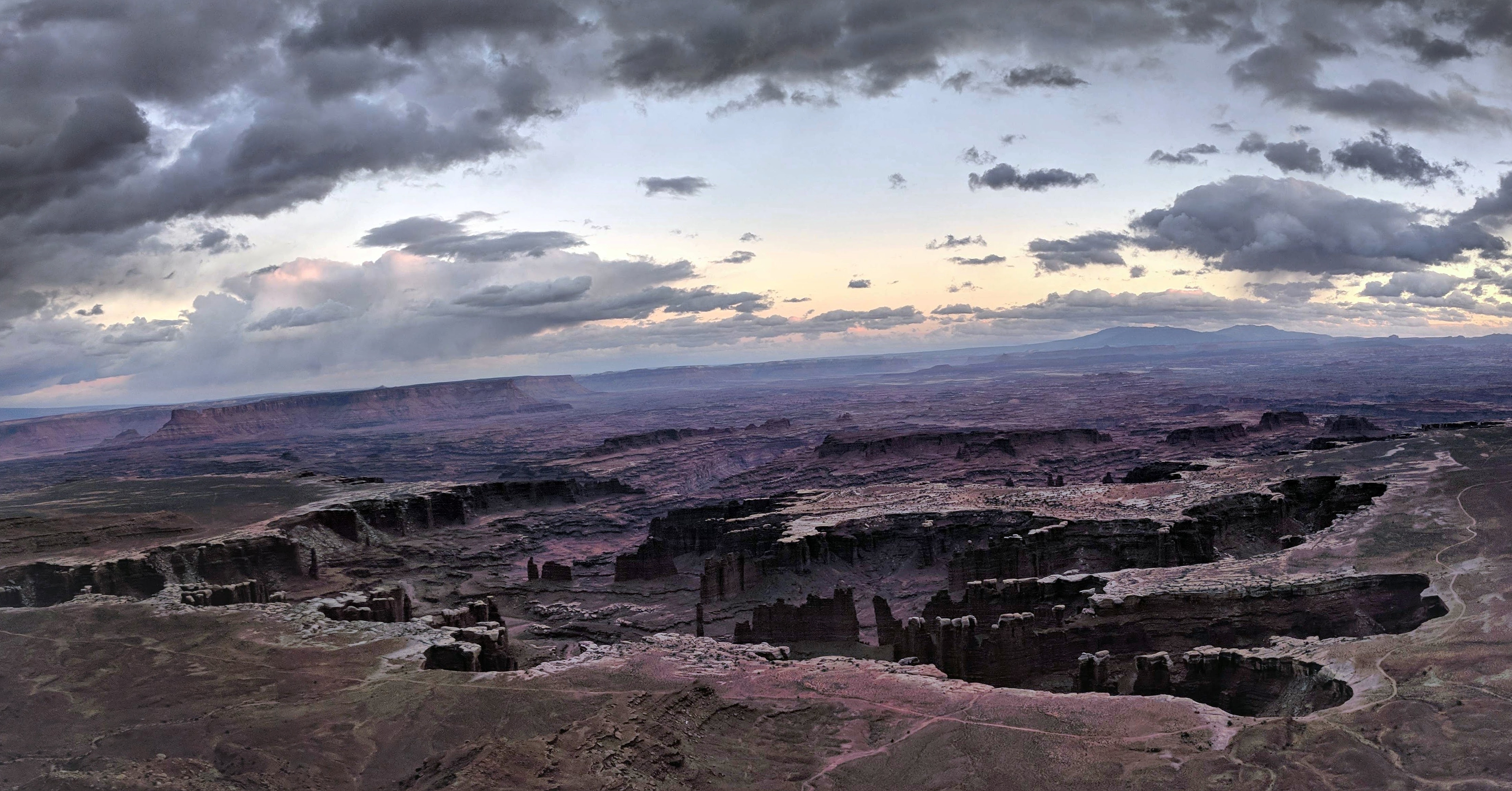
We continued deeper into the park and stopped again at Grand View Point. While the Shafer Canyon Overlook had gotten me excited the scene before me at Grand View Point blew my mind. It’s hard to describe the view, but it was vast and rugged and made me feel very very small. As we walked around the overlook trail we traced the White Rim Road some 1,000 feet below us, which traversed another layer of the canyon overlooking the Green and Colorado Rivers below. Even from high above on the Island in the Sky mesa we each mentally noted a few pucker worthy sections, where the road was right up against the canyon’s edge. Soon enough the earlier drizzle turned into steady cold rain and we ran back to the car. As we drove back to the campground the rain was coming down sideways and was looking more and more like a ‘wintery mix’ – the thermometer in the car read 32 degrees and we decided to head back to Moab and get a hotel for one last night in a warm bed before starting our bikepacking adventure.
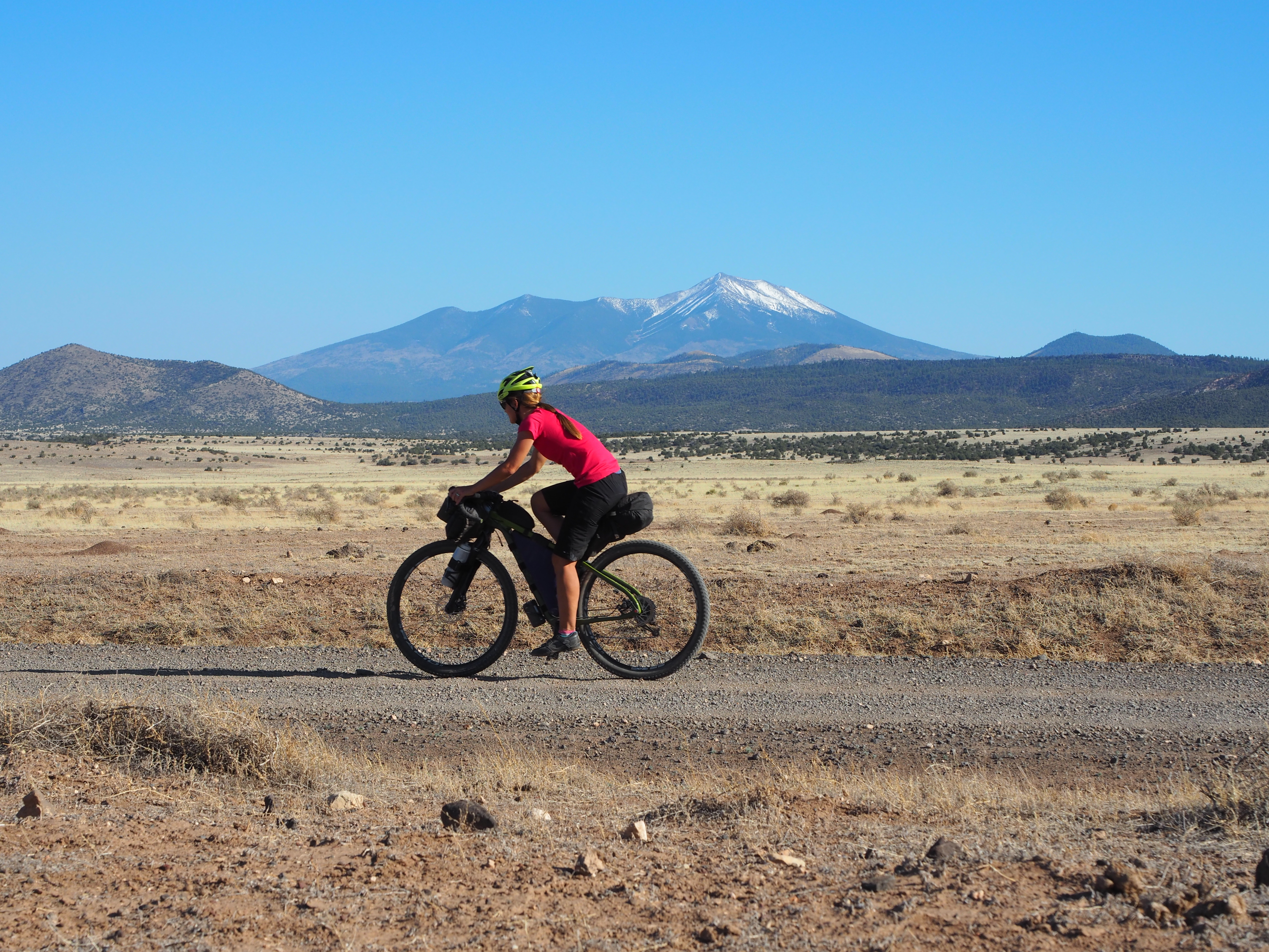
The next morning we woke up early and bundled up in several layers of clothing and drove back to a trailhead just before Horsethief Campground to park the car and head out on our fully loaded bikes. Neither of us packed much gear since we planned for one night on the trail and had to carry all of our water. Our goal for the first day was to make it Potato Bottom Campground, where we had a permit to camp, which was 72 miles from our starting location. Around 8:30 AM we set out and had roughly seven miles of pavement until we got to the Shafer Trail turn off that we had seen the day before. It was generally downhill which made the miles go by quickly, but it certainly didn’t help warm me up – despite the fact that I was wearing my ski gloves and shoe covers (they are like a wet suit for your feet that you wear over your shoes)! Three guys from Colorado rode passed us on their bikes while we were taking a picture by the park entrance, but other than that we had the road to ourselves.
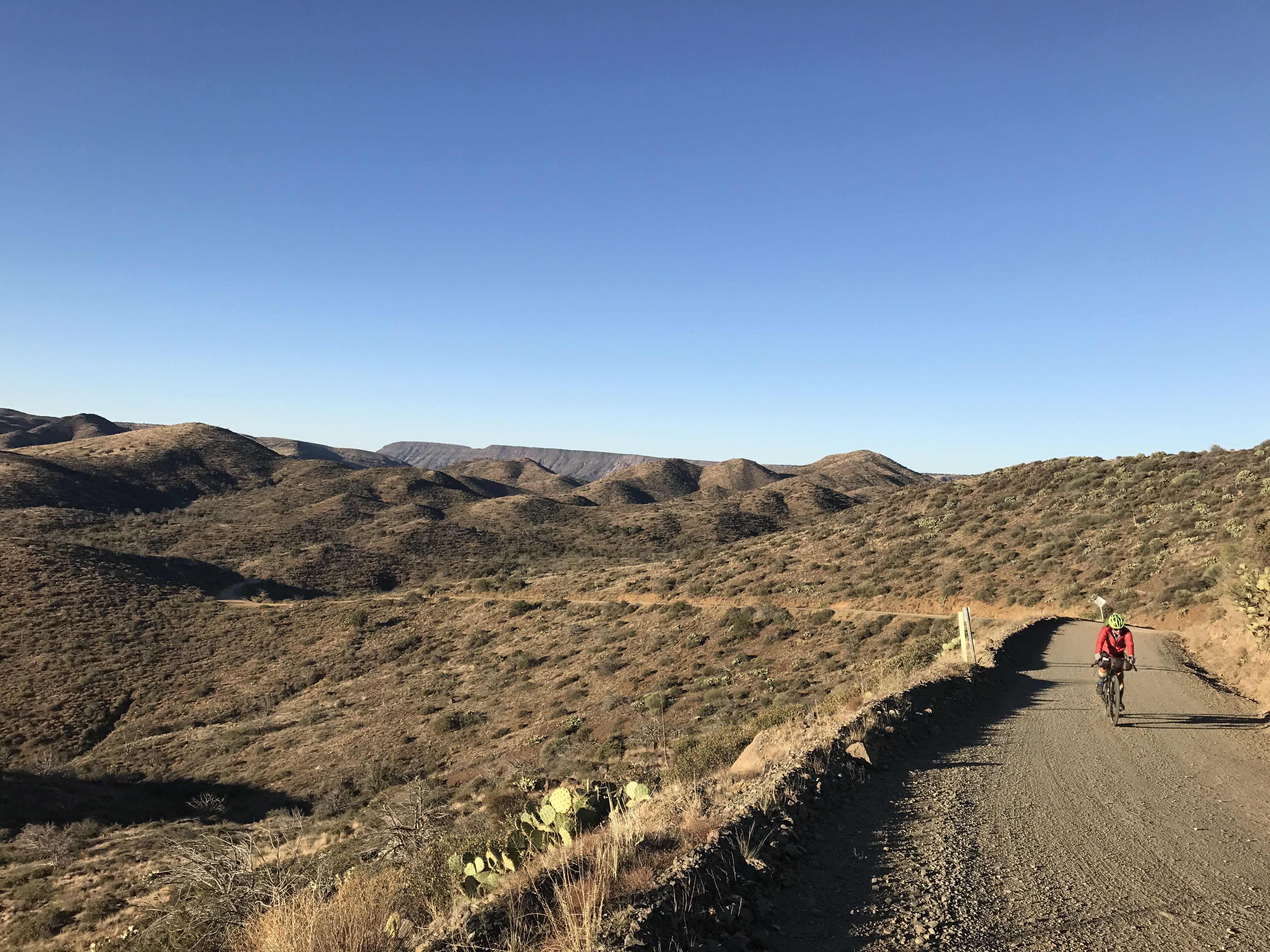
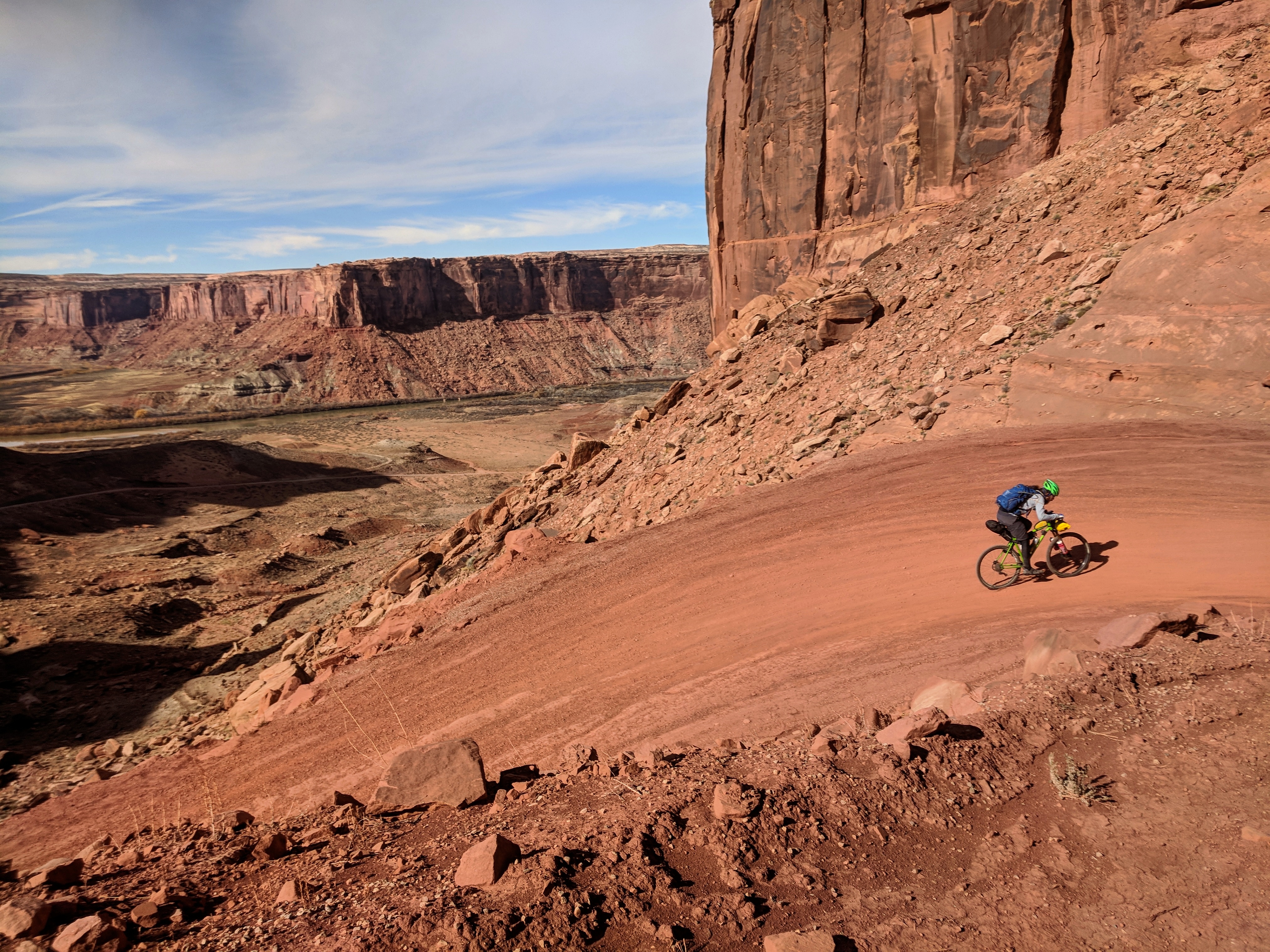
As soon as we started descending the Shafer Trail Switchbacks I became aware of the remoteness and expansiveness of the canyons we were entering. With each switchback I was overwhelmed with new views and was having a hard time focusing on riding my bike and making sure I didn’t drift over the edge or gain too much speed. I wanted to look down at the rivers below and up at the canyon walls or out at the pinnacles and spires jutting up from the canyon floor. The grade was between 12 – 15% and I decided it would be more enjoyable for me to walk some of the steep sections and look around instead of getting scared because of the extreme amount of exposure. We watched as the three riders from Colorado sped down the trail, eventually turning into three small dots that disappeared in the distance.
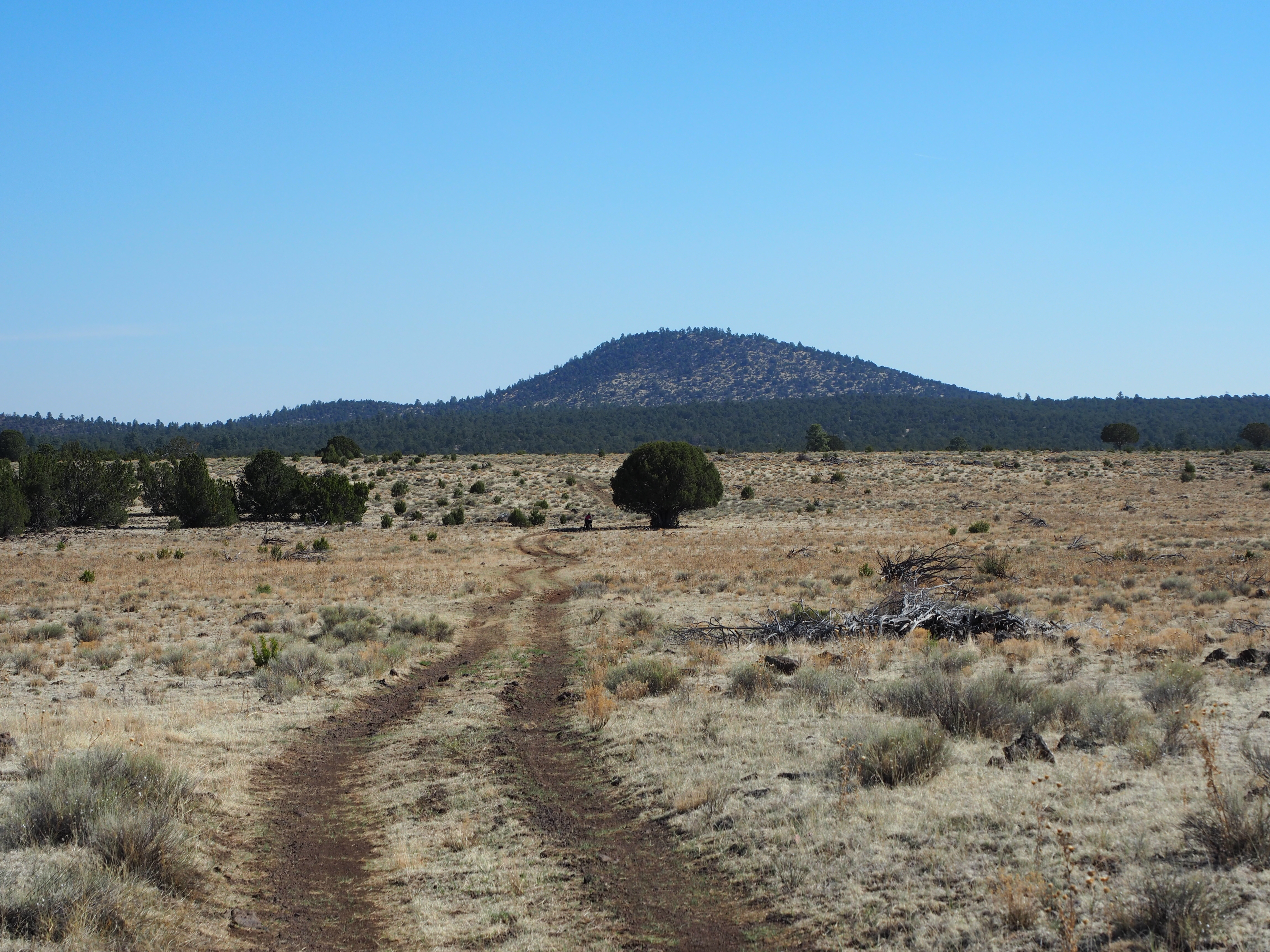
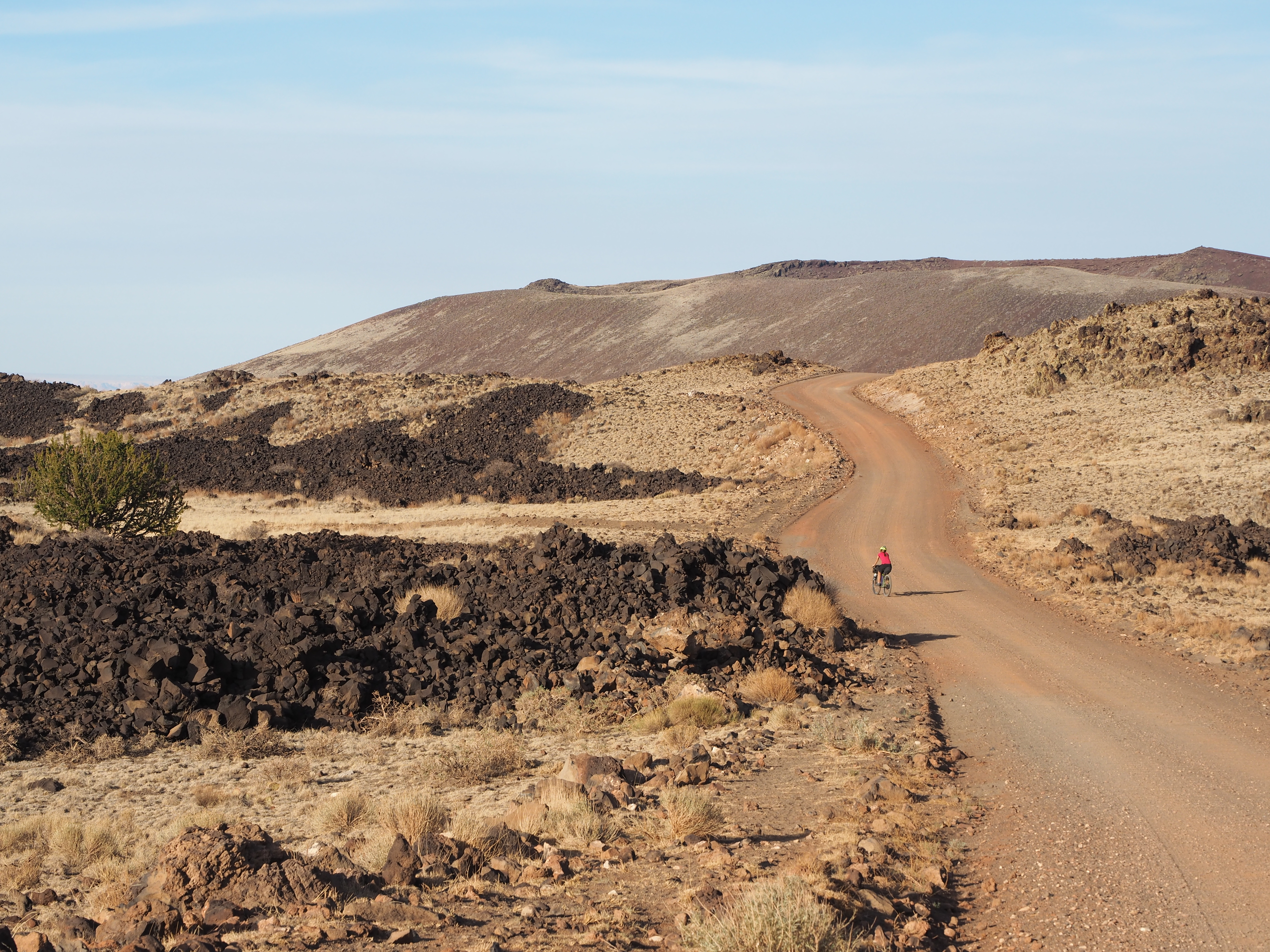
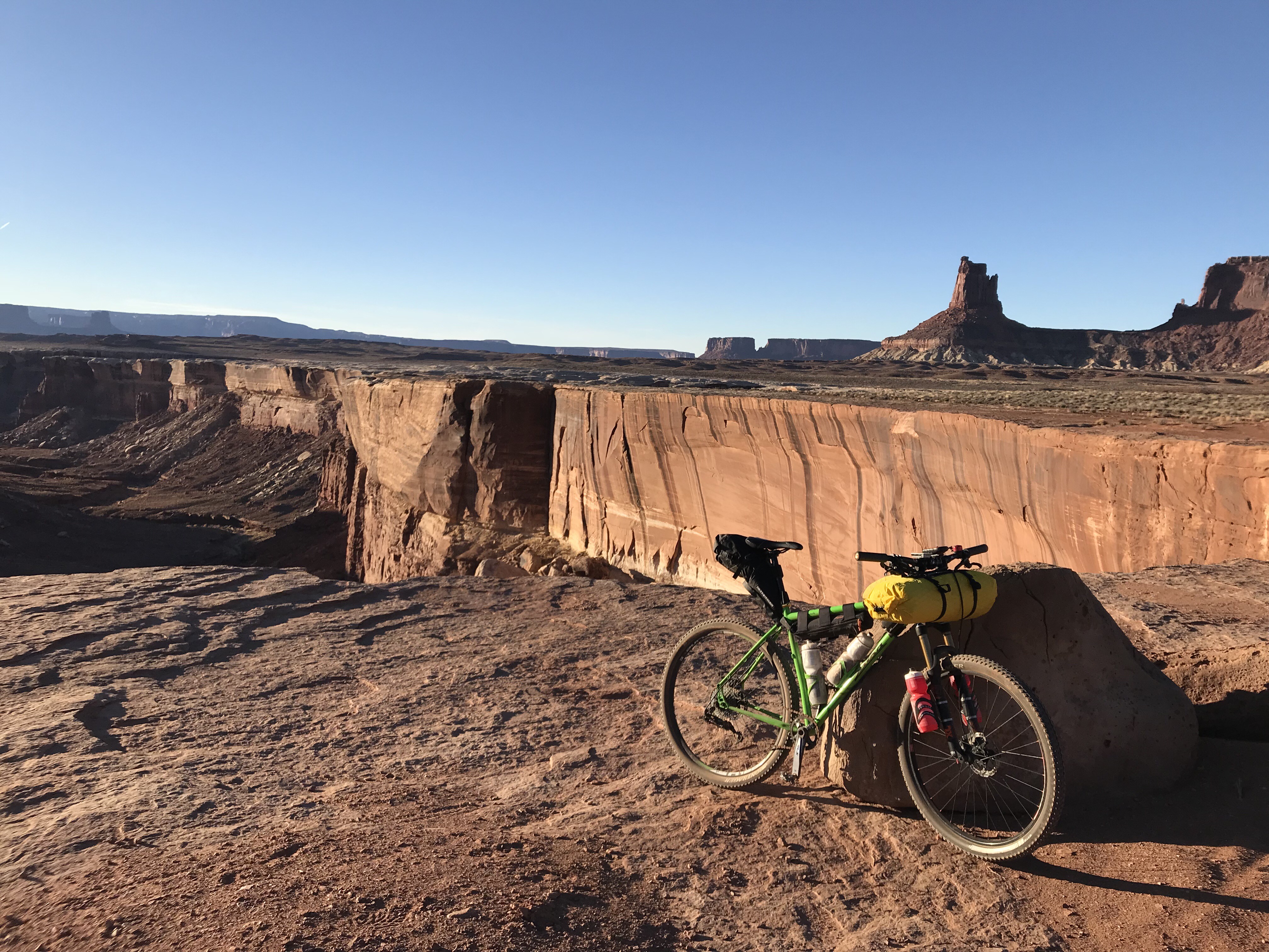
Once the grade mellowed out we jumped back on our bikes only to break a few minutes later to start shedding layers. We were finally out of the shade from the canyon walls and getting warmed by the desert sun. The next ten miles were relatively flat with short climbs and descents. We pedaled beneath sandstone walls and different monuments and mesas appeared with each twist and turn we took, we even got a few glimpses of the Colorado River further below. The road conditions varied from loose dirt, to sandy washes and sandstone rock formations. There was nothing technical, but lots of small ledges to ride up and over – enough to make my handlebar roll buzz against my tire each time I rolled off of one.
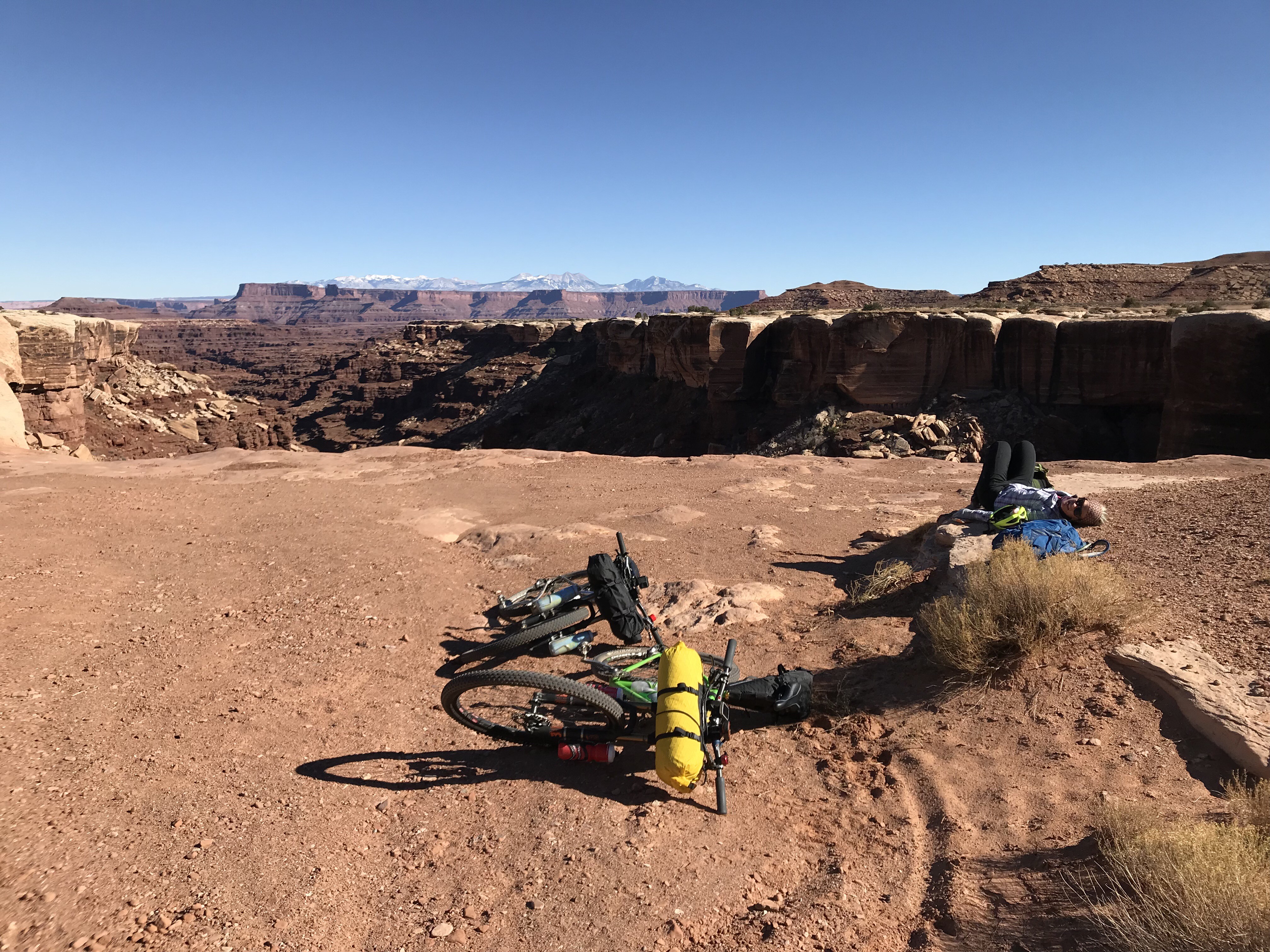
I carefully watched my GPS and our pace as we slowly meandered our way along the white rim. Three and half hours after we left the car we had only traveled twenty-five miles. With short winter days I knew we’d have to pick up the pace in order to have a relaxing evening at camp before sunset. While I knew our pace was slow because of all the pictures we were taking, I also knew my legs weren’t feeling responsive and my inner dialogue quickly became negative – I doubted myself and my ability. The self doubt and negativity started to impact me and I finally spoke up the next time I got on Ryan’s wheel. “Ryan, I have to tell you something,” I said, “I’m already feeling pretty tired, I don’t know if I can make it to camp before dark.” Fortunately, we’ve never been on a bike ride together where we are both having off days at the same time. This was no different. Ryan took my comments in stride and asked a few questions to make sure I was staying on top of my water and calories and suggested we take a break a few miles up the road to eat lunch. The truth was I was skimping on my calories, because I started foolishly worrying that I hadn’t packed enough food. My heavy backpack was also bothering me, so when we stopped for lunch I laid down on a nice rock bench to stretch out my back and shoulders.
I felt better right after telling Ryan that I was worried about my pace, it was as if saying it out loud gave me permission to stop beating myself up and enjoy the rest of the day. Unfortunately, the next twenty miles were a long gradual uphill slog. Luckily the epic views never let up so it was easy to keep my mind off of my fatigue. Despite the gradual uphill we did pick up the pace and were getting back on track to making it to camp. We ran into the guys from Colorado at the intersection of the White Crack Trail. They were waiting for their support vehicle and were running out of water. We stopped to talk and all admitted that the riding was slower going than any of us had thought. Since I had plotted out the route on Strava beforehand I also incorrectly announced that we had already completed most of the climbing for day one. Little did I know my Strava projections were off by over 1,000 feet and we had a gnarly one mile climb ahead of us. We eventually got to that climb up to Murphy Hogback, here the road turned into extremely loose dirt with large rocks and the grade exceeded 30% in some sections with little space between you and tumultuous fall over the edge into the canyon below. We resorted to pushing our bikes uphill – which seriously slowed us down. The conditions on the descent were the same, so I unfortunately had to walk down the other side as well. Reaching Potato Bottom before dark was no longer in reach so we decided we’d ride to Candlestick Campground – which was only ten miles further versus the twenty-one to Potato Bottom.
During the last ten miles golden hour started to set in and the canyon walls lit up with hues of orange, red, and brown. It was an incredible sight. We got passed by a few more energetic riders and supporters who happened to be camping at Candlestick. When we arrived there they graciously welcomed us and shared their warm food and booze with us, which was awesome since Ryan forgot his flask back in the car. As we stood in the middle of nowhere, under a star filled sky, surrounded by an assortment of bikes and camping gear with a handful of strangers – I was reminded why I love this community so much.
I had difficulty falling asleep that night because the air was so cold, but my core temperature was still high from all of the riding. Despite my restlessness it was an incredibly quiet night. In addition to being in an extremely remote location, riding the White Rim Road requires a permit so the number of people, bikes and vehicles out there are quite limited. It was also hard not to notice the complete lack of wildlife, I didn’t hear a single howling coyote or hooting owl the entire night.
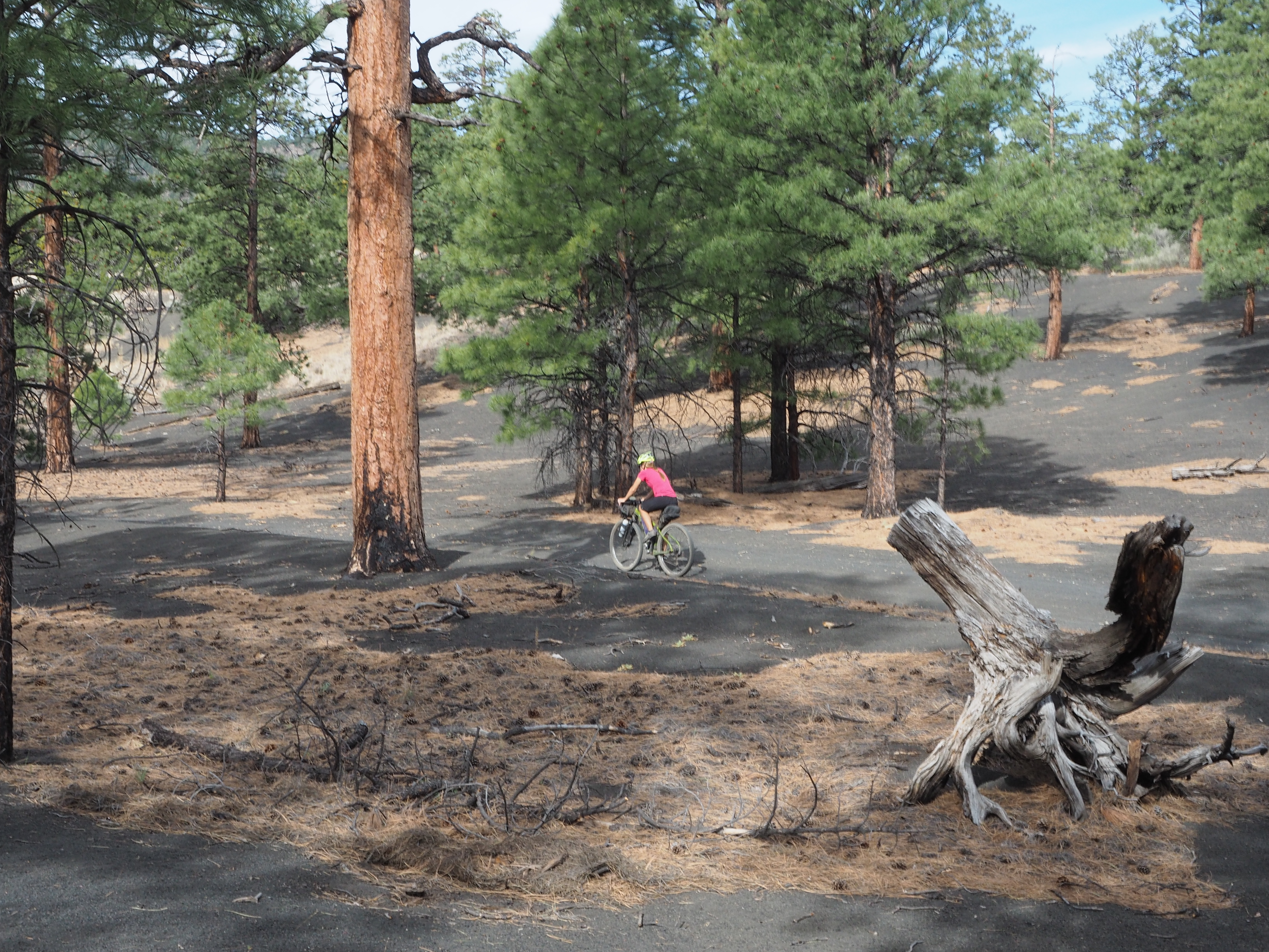
When we woke up the next morning there was ice all around the tent and the temperature on our GPS read 26 degrees. We quickly tore down camp and got back on our bikes to finish the ride. Shortening day one meant we had 38 miles ahead of us – with a fair amount of climbing. The road eventually meets the Green River and travels beside it for several miles before intersecting with Mineral Bottom Road, which climbs out of the canyons. The first eleven miles to Potato Bottom were downhill and easy riding. At Hardscrabble we encountered a one mile climb that was reminiscent of Murphy – the grades were over 20% but this time we were riding through sand. I felt like a football player pushing a sled and came close to face planting a few times as I tried to keep my footing. After another steep descent it was flat riding along the river and through sandy washes for the final eight miles on the White Rim Road. In a few places the sand was too deep to ride through on a fully loaded bike so it was on and off the bikes as we made our way out of Canyonlands.
As we came upon the intersection of the White Rim Road and Mineral Bottom Road a show unfolded in the sky before us. Base jumpers were lining up on the cliffs at the top of the Canyon and one by one jumping down to where we stood below. This provided some entertainment for us as we had a quick bite to eat before starting the arduous climb ahead of us. Mineral Bottom Road, like the Shafer Trail is a tight network of switchbacks climbing back up toward the Island in the Sky. There are no guardrails and the exposure and drops offs are no joke. The road climbs almost 1,000 feet in 1.5 miles. I decided to get a head start on Ryan while he watched the base jumpers and started steadily making my way out of the canyon. The first half of the climb was manageable but as I began navigating the short switchbacks near the top the amount of traffic increased as base jumpers shuttled back and forth and the exposure started bother me. My legs were also cooked from the previous day so I surrendered to walking my bike up the last section of the climb.
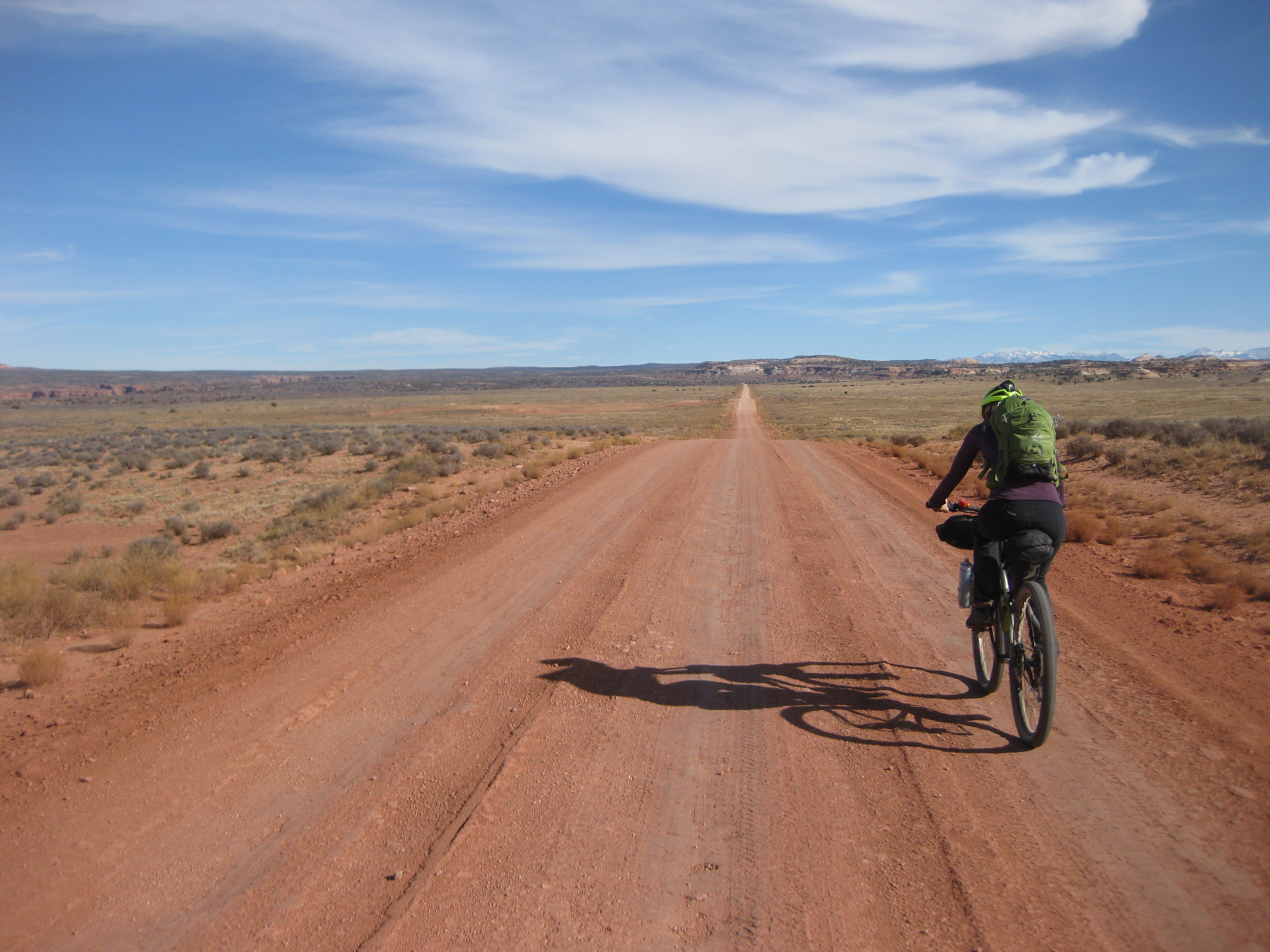
The final thirteen miles to the car were a slight uphill and cut through a sprawling prairie. It didn’t take long for it to become hard to imagine there was a colossal canyon just a few hundred feet away. The canyons became hidden in flat plateau that stretched out as far as the eye could see. The scenery changed less frequently here making it hard to think about anything other than my aching legs and the fact that my backpack was becoming the bane of my existence – it was quite literally a pain in the neck. At this point we were both ready for the ride to be over, when faced with these circumstances Ryan tends to speed up and try to finish the ride as quickly as possible – trying to ‘get it over with’. I on the other hand evaluate everything causing me pain and angst and dial my effort to whatever will be the most tolerable for the duration of the activity. These vastly different approaches caused Ryan to drift further and further ahead as I slothfully made my way back to the car. I didn’t think it would have been possible for us to travel slower than we had on day one, but it seemed with each passing mile my pace slowed. Finally, Ryan suggested strapping my backpack on to his, when I protested he said “This will help me because it will help you go faster!” Soon enough we made it back to the car, took our time to unload our gear and enjoyed celebratory cokes!
Camping Alone: My First Solo Bikepacking Trip
“The more time I spend alone the more I feel comfortable being alone.” – Lael Wilcox
That quote really resonated with me as I watched Fast Forward, the short film about Lael Wilcox’s AZT attempt, for a second or third time at the Banff Mountain Film Festival. Not only did it resonate with me but it shocked me. You see, I have a tendency of putting other endurance athletes up on pedestal and projecting super human qualities onto them, in the process I often ignore the fact that they are regular people just like me. While their accomplishments are impressive they do not achieve such accomplishments without facing the challenges that I face myself. When I actually listened to Lael say those words instead of just hearing them I knew it was time to stop making excuses. If I really wanted to get into ultra-endurance racing I needed to start making myself uncomfortable. (more…)
Big Bear, Big Fail
Standing there with tears streaming down my wife’s face while horseflies and mosquitoes mercilessly attacked us I had a decision to make: do we press on towards the campsite or do we hit the metaphorical abort button? The only problem was turning back meant a five mile climb, with most of that being hike a bike. Where was this chapter in the Bikepacking guidebook? When do you decide to call it quits and throw in the towel? (more…)